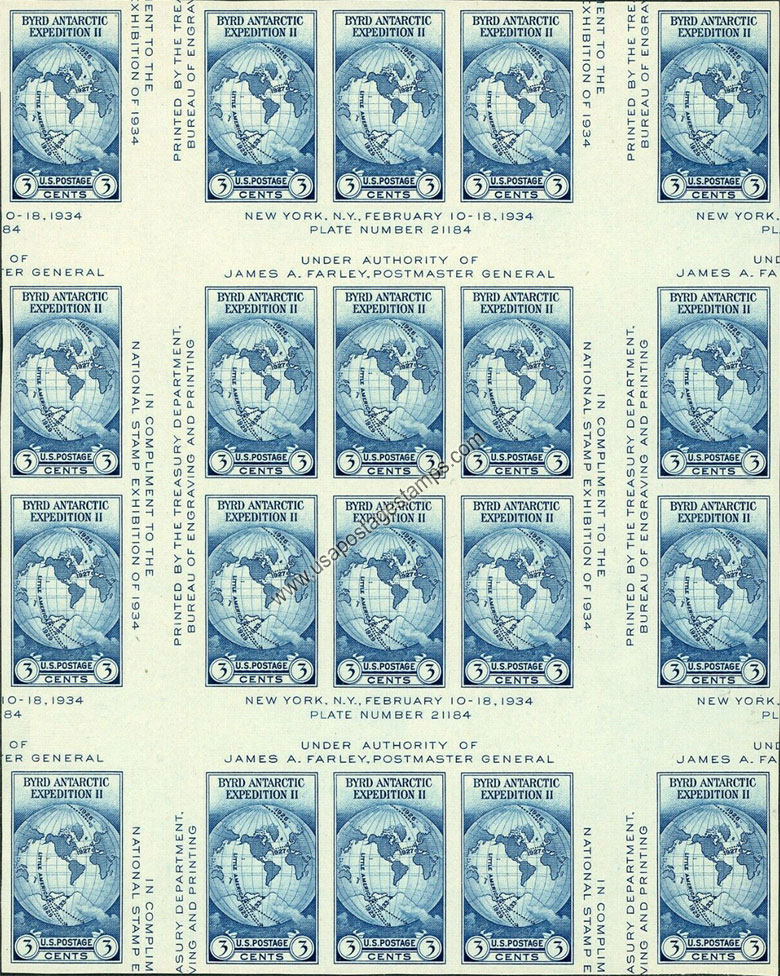
US 1935 National Stamp Exhibition ; Byrd Antartic Expedition II Imperf. 3c.x6 Scott. 768 S/S

Series: National Stamp Exhibition Issue
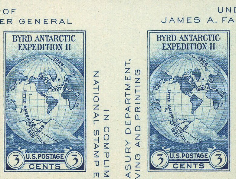
Stamp details: Byrd Antartic Expedition - World Map on van der Grinten Projection
Issued date: 15-03-1935 (dd/mm/yyyy)
Face value: 3c.x6
Emission: Commemorative
Format: Souvenir Sheet (S/S)
Watermark: No Watermark
Catalogue No:-
Scott (USA): 768
Printer: Bureau of Engraving and Printing
Stamp Colors: Dark blue
Perforation: Imperforate
Themes: Map, Globe, Explorers
Total print: 267,200 (estimate)
Note: The Farley Special Printing.
A margin of at least 18mm (gutter distance between stamps in printed panes) must be present to distinguish from the regularly printed souvenir sheet.
Description:- The van der Grinten projection is a compromise map projection, which means that it is neither equal-area nor conformal. Unlike perspective projections, the van der Grinten projection is an arbitrary geometric construction on the plane. Van der Grinten projects the entire Earth into a circle. It largely preserves the familiar shapes of the Mercator projection while modestly reducing Mercator's distortion. Polar regions are subject to extreme distortion. Lines of longitude converge to points at the poles.
Source: en.wikipedia.org/wiki/Van_der_Grinten_projection
Source: en.wikipedia.org/wiki/Van_der_Grinten_projection
* Philatelic Auction Houses
* Philatelic Books
* Philatelic Federation
* Philatelic Libraries
* Philatelic Magazines
* Philatelic Society
* Stamp Dealers Association
* Stamps Exhibitions
* US Post Offices
* Worldwide Philatelic Bureau